


Click an illustration to enlarge it.
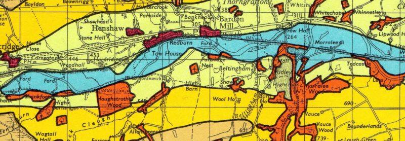
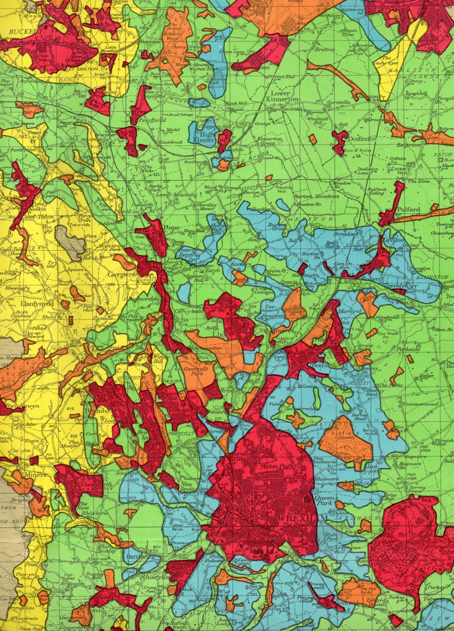
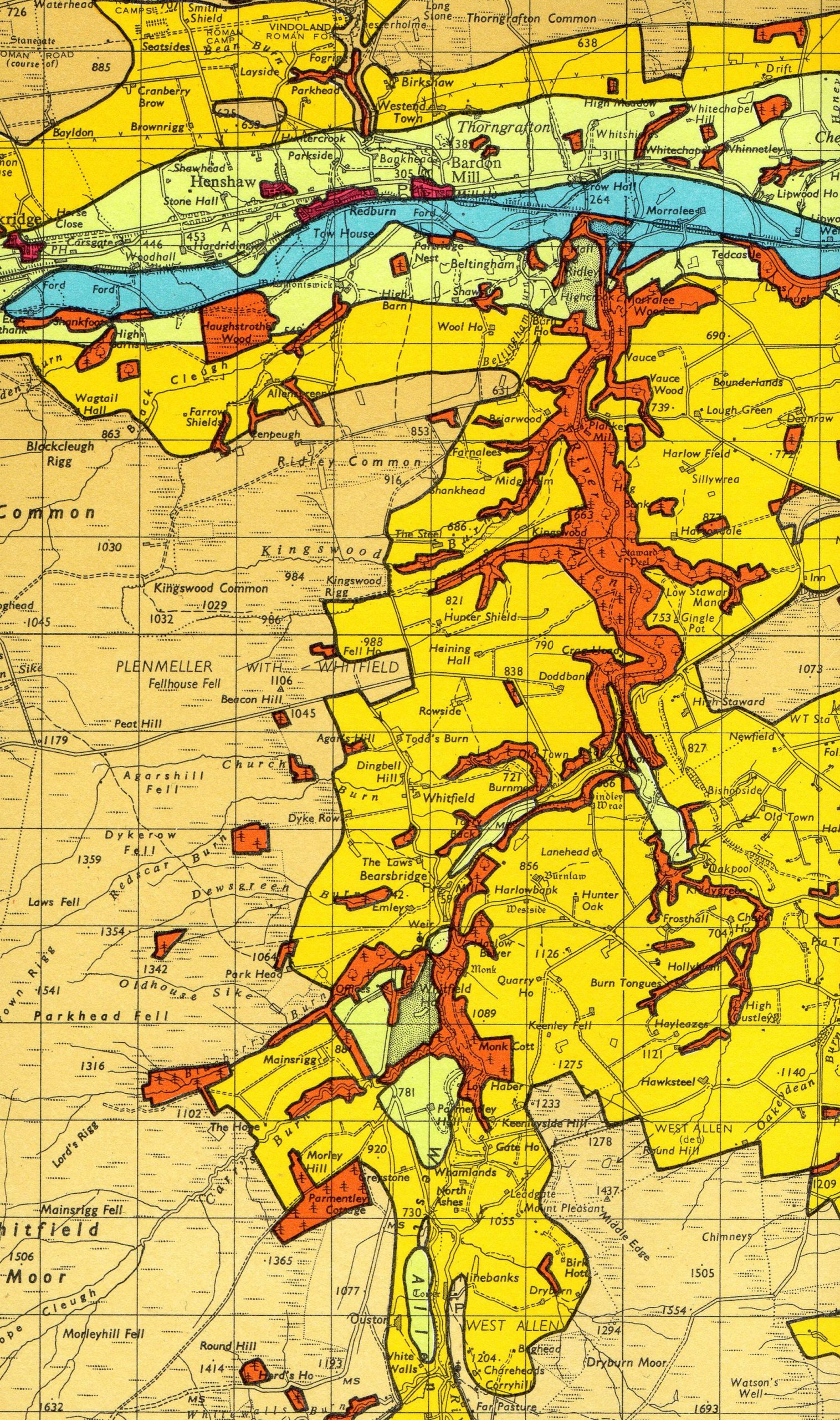
Agricultural Land Classification of England and Wales
The Provisional edition was published 1965-75. Issued by the Ministry of Agriculture, Fisheries and Food, and printed on Ordnance Survey one-inch Seventh Series base maps.
Highly coloured maps with different colours for :
a. Agricultural land, Grades 1 to 5,
b. Non-agricultural land :
b1. Land in urban use,
b2. Other land primarily in non-agricultural use.
The following sheets are available, in good bright condition, paper folded, £12 each, postage included.
75 Dumfries & Gretna
76 Carlisle
77 Hexham
78 Newcastle upon Tyne
82 Keswick
83 Penrith
84 Teesdale
85 Durham
86 Redcar & Whitby
88 Barrow-in-Furness
89 Lancaster and Kendal
90 Wensleydale
91 Ripon
92 Pickering
93 Scarborough
94 Preston
95 Blackburn & Burnley
96 Leeds & Bradford
97 York
98 Market Weighton
99 Hull
100 Liverpool
101 Manchester
102 Huddersfield
103 Doncaster
108 Denbigh
110 Stoke on Trent
111 Buxton & Matlock
112 Nottingham
119 Stafford
120 Burton upon Trent
121 Derby & Leicester
122 Melton Mowbray
123 Spalding
130 Kidderminster
131 Birmingham
132 Coventry and Rugby
133 Northampton
134 Huntingdon & Peterborough
136 Bury St. Edmunds
137 Lowestoft
138/151 Fishguard and Pembroke
139 Cardigan
140 Llandovery
141 Brecon
144 Cheltenham and Evesham
146 Buckingham
147 Bedford & Luton
149 Colchester
150 Ipswich
153 Swansea
161 London N.E.
162 Southend-on-Sea
163 Barnstaple
164 Minehead
165 Weston-super-Mare
167 Salisbury
168 Winchester
169 Aldershot
170 London S.W.
171 London S.E.
172 Chatham & Maidstone
173 East Kent
176 Exeter
177 Taunton & Lyme Regis
178 Dorchester
179 Bournemouth
180 The Solent
181 Chichester
182 Brighton & Worthing
183 Eastbourne
184 Hastings
185 Newquay & Padstow
186 Bodmin and Launceston
187 Plymouth
188 Torquay
189 Land’s End
190 Truro and Falmouth
Full details of this series, and over 1,000 other map series, including all the variant editions, and any related district maps can be found in Ordnance Survey small-scale maps : indexes 1801-1998 by Roger Hellyer. Far more than just index diagrams.
You might also be interested in Map cover art by John Paddy Browne, which is the standard work on Ordnance Survey map covers.